
Red Centre road trip: Alice Springs to Uluru
≈ 665 km driving in total · ~8 h · ideal in 7 days · 4 stops
The drive into the middle of Australia, where the road runs dead straight for hours and the rock at the end is nothing like the postcard. Three of the country's great walks are strung along it — a gorge system west of Alice, a canyon rim, and the base of Uluru itself — and the desert night sky is the fourth attraction.
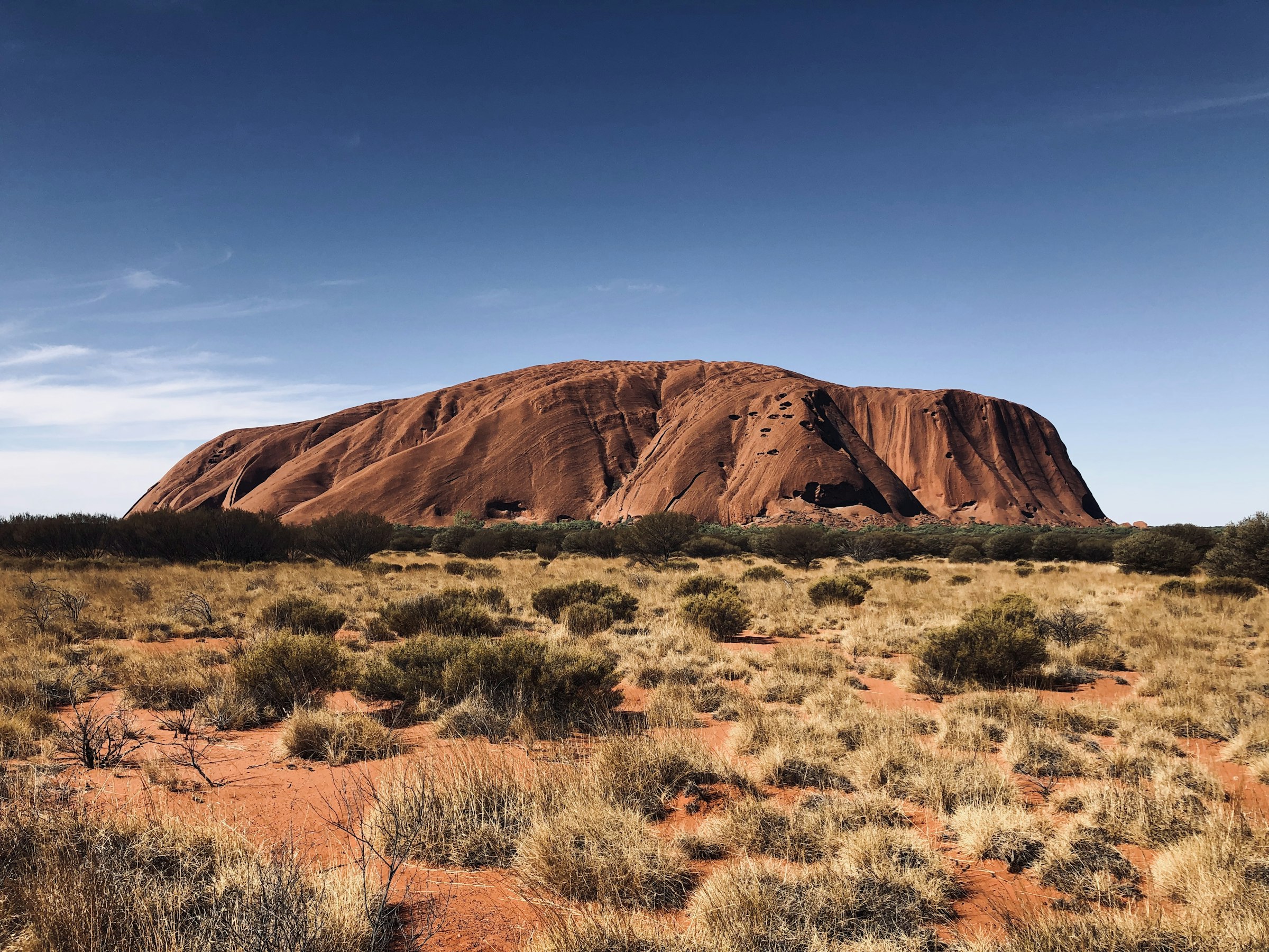
Photo: Unsplash
Free · no sign-up · drag the stops, see drive times, find places to stay & charge
The route at a glance
- Alice Springs — 2 nights
- Glen Helen — 1 night
- Kings Canyon — 1 night
- Uluru — 2 nights
The stops
- 1
Alice Springs
The Royal Flying Doctor Service base and the Telegraph Station explain how anyone lives out here at all. Anzac Hill at sunset gives you the MacDonnell Ranges in profile.
- 2
Glen Helen
The West MacDonnell gorges — Ormiston, Ellery Creek, Simpsons Gap — are permanent waterholes in a desert range, and cold enough to hurt. Swim anyway.
- 3
Kings Canyon
The Rim Walk climbs 500 steps in the first fifteen minutes, then delivers six kilometres of sandstone domes and a palm-filled chasm called the Garden of Eden. Start at first light.
- 4
Uluru
Walk the 10 km base track and the monolith stops being a shape and becomes a place — caves, waterholes, rock art. Then drive 50 km west for Kata Tjuta's Valley of the Winds.
Good to know
Do this May–September. Summer here regularly exceeds 40°C and rangers close the long walks after 11am, or entirely. Carry far more water than feels sensible (3 L per person per day minimum) and fuel at every roadhouse — the gaps are 200 km+. Climbing Uluru has been prohibited since 2019; the Base Walk is the experience anyway. Park entry to Uluru-Kata Tjuta is ticketed and valid three days.
Red Centre road trip: Alice Springs to Uluru — FAQ
- How long does the Red Centre road trip take?
- 7 days is comfortable — about 8 hours behind the wheel across 4 stops, ≈ 665 km of driving in total.
- How far is Uluru from Alice Springs?
- This itinerary covers ≈ 665 km (413 miles) of driving in total, via Glen Helen, Kings Canyon.
- What are the best stops between Alice Springs and Uluru?
- Glen Helen, Kings Canyon — each one is on the route below. Open the trip on the map to add, drop or reorder them.
- Where should you stay on the Red Centre road trip?
- The itinerary sleeps in Alice Springs, Glen Helen, Kings Canyon, Uluru. Open it on the map to see places to stay along the route and what the nights will cost.
More road trips
Wondering what it adds up to? See what this and every other route costs — stays, food, getting around and fuel, priced by region and season before you book anything.
Or start from a blank map and build your own — Stopful shows drive times between stops, splits long days, finds hotels and EV chargers along the route, estimates what the trip will cost before you book, and tracks the budget as you plan.